Cannstatter Volksfest Map Guide: how to navigate the Wasen like a regular visitor
The Cannstatter Wasen can feel simple from the outside and confusing once you are inside the crowd. This practical map guide explains how to think about arrival points, beer tents, ride streets, food routes, meeting points, toilets, transport exits and family-friendly navigation.
Map mindset
The Wasen is easier when you think in zones
Most visitors do not need to memorise every stand, ride or path before arrival. What matters is understanding the festival ground as a group of zones: transport edges, beer tent areas, ride streets, food routes, services and meeting points.
During quiet hours, you can walk and explore freely. During the evening, the same ground feels more compressed. Groups move toward tents, ride lines grow, food stalls become busy and transport exits become important. If you know which side you entered from and where you need to leave, the festival becomes much easier.
A map is most useful before the day begins and during the first 30 minutes on the grounds. After that, visual memory matters. Notice large rides, tent names, main paths and where the crowd is flowing. The best Wasen navigation is a mix of preparation and simple landmarks.
Experienced visitor tip: On arrival, spend five minutes doing nothing except orienting yourself. Find your entry side, nearest transport exit, nearest toilets and the direction of your chosen beer tent.
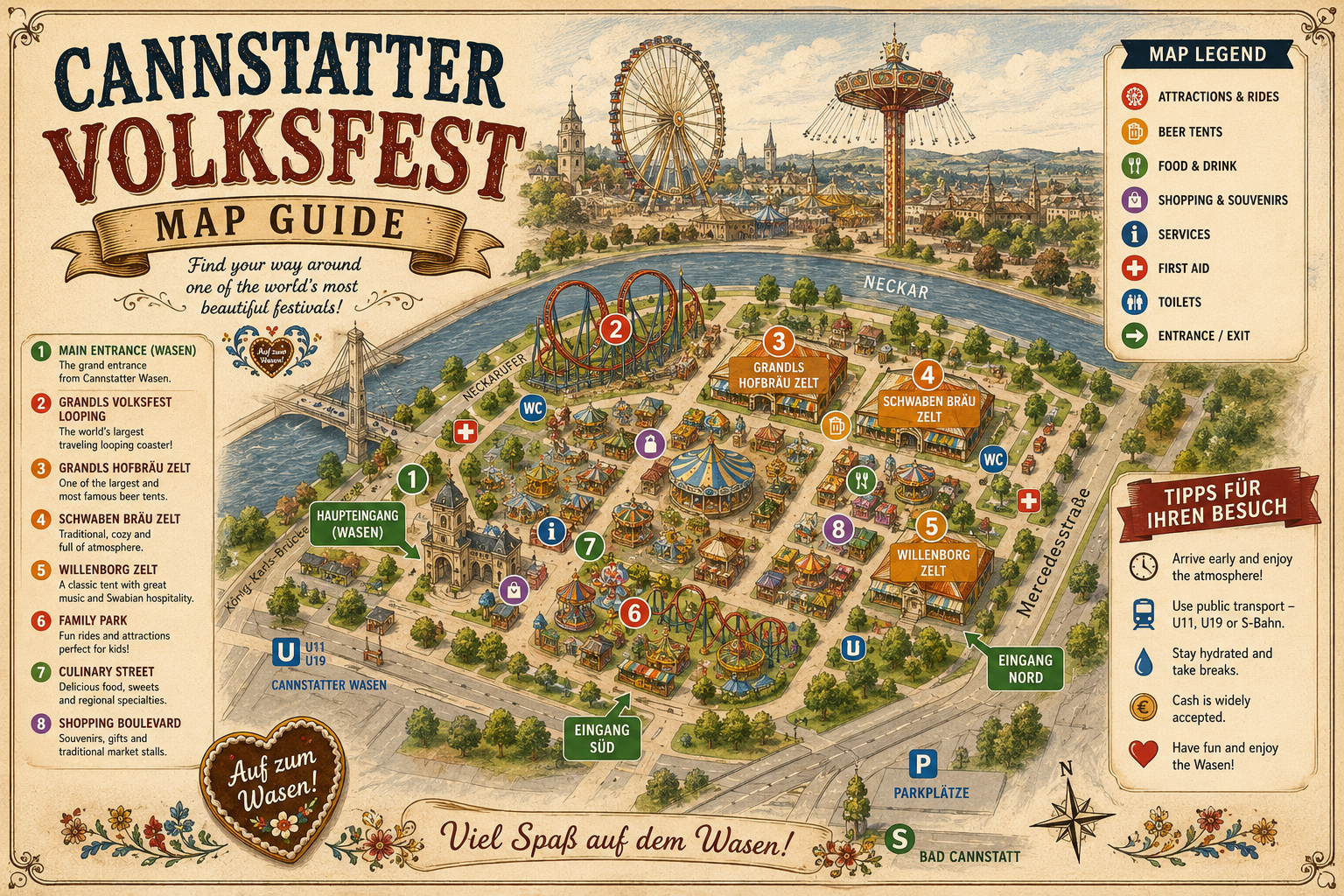
Visual layout
A practical zone-style view of Cannstatter Wasen
This is not a technical survey map. It is a visitor-friendly way to understand how the main parts of the festival connect.
Transport edge
Bad Cannstatt, NeckarPark, Mercedesstraße and Cannstatter Wasen approaches. Use this zone to enter, exit and set meeting points.
Beer tent zone
Large tents, reserved entrances, walk-in areas, security points, food service and evening music.
Ride streets
Thrill rides, family rides, wheels, games and bright fairground attractions.
Food routes
Quick snacks, sausages, sweets, roasted almonds, pretzels, crêpes and takeaway bites.
Service points
Toilets, first-aid awareness, information points, accessible routes and practical rest stops.
Meeting landmarks
Large visible rides, tent-side corners, clear entrances and transport routes where groups can regroup.
Arrival points
How each transport stop changes your first steps
Your arrival stop affects how the Wasen first appears. Choose the stop that fits your hotel route and return plan, not only the one that looks closest.
| Arrival point | Best for | How to use it | Visitor advice |
|---|---|---|---|
| Bad Cannstatt | S-Bahn, regional rail, central Stuttgart connections and day visitors. | Walk with the event flow toward the festival ground. | Useful if you want a major station and do not mind a short walk. |
| NeckarPark | Event district, stadium side, Mercedes-Benz Museum area and nearby hotels. | Approach from the NeckarPark side and orient toward the Wasen. | Good if combining the festival with nearby venues. |
| Mercedesstraße | U-Bahn routes from several Stuttgart areas. | Use it as a practical light rail approach to the Wasen. | A useful alternative when direct festival stops are crowded. |
| Cannstatter Wasen | Direct festival stop when service is operating. | Arrive close to the event ground and follow current crowd guidance. | Good for first-time visitors if the route from your hotel is simple. |
| Taxi area | Visitors with mobility needs, late returns or hotels with weak transit. | Use recognised taxi points rather than vague pickup requests. | Demand can be high after peak tent hours. |

Finding beer tents
Beer tent navigation needs more precision than fairground walking
If you have a beer tent reservation, the map matters more. You need the correct tent, correct entrance, correct time slot and a group that arrives together.
Large tents such as Grandls Hofbräu Zelt, Göckelesmaier, SchwabenWelt and Fürstenberg Festzelt can be busy around peak periods. Being near the tent is not the same as being at the right entrance. Groups should identify the tent before the reservation time, not at the last minute.
If you are visiting without a reservation, use the map to stay flexible. Check more than one tent option, enter earlier and avoid building the whole evening around a single late walk-in attempt.
Family navigation
Families should use a smaller map
Families do not need to see the entire Wasen. A smaller, calmer route is usually better.
Choose one ride area
Pick a manageable cluster of rides rather than crossing the ground repeatedly. Children enjoy the day more when walking is limited.
Identify toilets early
Do not wait until a child urgently needs one. Notice toilets during the first walk.
Use visible meeting points
Choose a large ride or clear corner. “Near the food stalls” is too vague when the crowd grows.
Keep the exit close
Families should avoid ending the day far from their transport route after children are tired.
Eat before sweets
Plan a savoury stop before the sweet stall route takes over the day.
Leave earlier
Exiting before the late crowd is a map decision as much as a parenting decision.
Navigation plan
A simple first-hour route for the Wasen
Use this route if it is your first time and you want to avoid wandering without purpose.
Mark your arrival side
Notice whether you arrived from Bad Cannstatt, NeckarPark, Mercedesstraße or Cannstatter Wasen. This determines your return route.
Find a meeting point
Choose a clear place the whole group can remember. Take a photo if needed.
Locate key services
Find toilets, food options and the direction of first aid or information points as you move.
Find your tent or ride zone
If you have a reservation, locate the tent. If you are with children, identify the ride cluster you will use.
Confirm the exit before evening
Before the grounds become dense, make sure the group understands how to leave.
Food and service routes
Food areas are part of navigation, not only eating
Food stalls create natural pauses and meeting points. They are useful when groups need a break, when families need to reset or when visitors want to avoid entering a tent too early.
Look for savoury options first: sausages, pretzels, roast chicken, Schupfnudeln, potato dishes or tent meals. Then treat sweets as a walking route: roasted almonds, crêpes, chocolate fruit, candy and gingerbread hearts.
During busy periods, food areas can become crowded too. If you see a good food stop before peak hunger time, use it. Waiting until everyone is tired makes navigation harder.
Food map tip: Use food breaks to check the next route, not only to eat. It is the easiest moment to regroup.
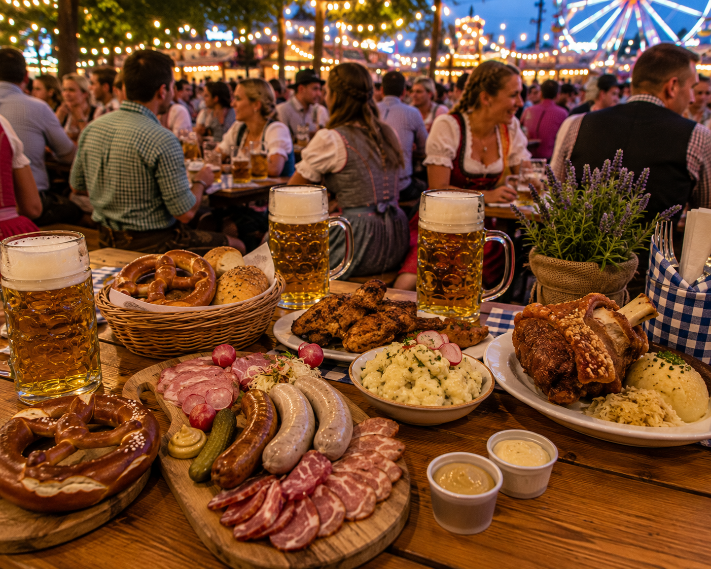
Map mistakes
Navigation mistakes first-time visitors make
Most map mistakes happen because visitors assume the Wasen will feel the same at night as it did on arrival.
| Mistake | Why it causes problems | Better approach |
|---|---|---|
| Not knowing the arrival side | Visitors struggle to find the right exit later. | Memorise or photograph your entry route. |
| Meeting “near the tent” | Large tents have multiple sides and crowded surroundings. | Choose a specific visible landmark. |
| Finding the tent too late | Peak crowds slow movement and entry checks take time. | Locate the tent before the reservation time. |
| Crossing the grounds repeatedly with children | Children become tired and parents lose patience. | Choose one smaller ride and food zone. |
| Ignoring toilet locations | Urgent searches are stressful in crowds. | Notice toilets early during the first walk. |
| Leaving with the biggest exit wave | Transport and paths become more crowded. | Leave slightly earlier if comfort matters. |
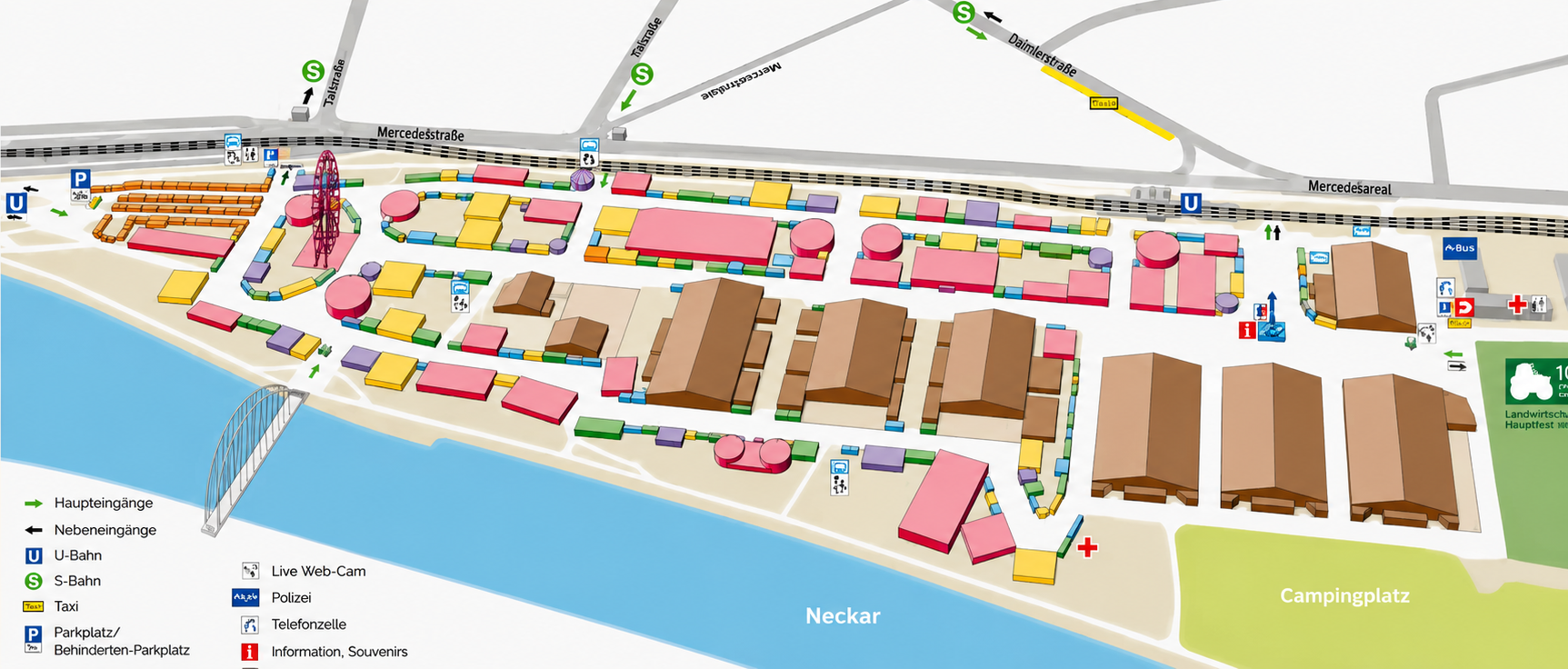
Exit strategy
The best map decision is often the exit decision
A good Wasen visit ends smoothly because the exit was planned before the evening became busy. This matters for families, groups, international visitors and anyone staying outside Bad Cannstatt.
If your route home is by public transport, know the station and direction. If your group is splitting, decide where the split happens. If you plan to use a taxi, choose a recognised taxi area rather than a random pickup point in moving crowds.
For large groups, leaving together is easier than trying to gather after people have scattered. For families, leaving before children become exhausted is the best route choice of the day.
Use the map before the crowd decides your route
Arrive, orient yourself, choose a meeting point, find your tent or ride zone and confirm the exit before the evening rush. The Wasen is much easier when the map is part of the plan.
Festival map FAQ
Cannstatter Volksfest map FAQ
Where is Cannstatter Volksfest located?
Cannstatter Volksfest takes place at Cannstatter Wasen in Bad Cannstatt, Stuttgart.
Which stops are useful for reaching the Wasen?
Useful stops include Bad Cannstatt, NeckarPark, Mercedesstraße and Cannstatter Wasen, depending on your route and current service.
How should groups choose a meeting point?
Groups should choose a specific visible landmark, such as a large ride, clear entrance or transport-side point, instead of a vague area.
Is the Wasen easy to navigate with children?
Yes, if families use a smaller route, choose one ride area, identify toilets early and leave before late evening crowd pressure.
Should I find my beer tent before my reservation time?
Yes. Locate the tent and correct entrance before peak crowd periods so the group is not rushed.
What is the most important map tip?
Know your exit route before entering the busiest areas. The return journey is easier when planned early.